Salmon Fishing on the River Halladale
Apart from in its upper course, in the Forsinard area, the River Halladale is, for most of its twenty mile length, a rather sluggish salmon river. Nevertheless, this northern Sutherland river can provide excellent salmon fly fishing. Very much a spate river, the Halladale relies very much on rain to give good sport, and the rule, as on most other northern rivers, is fly only.
The Halladale river rises in the hills to the south east of Forsinard and flows northwards to enter the sea at Melvich. Salmon can be taken in April but the best months are from June to September. Overall, the average size of fish is about 7 pounds but, given rain, there can be a lot of them. The earlier run of Spring fish average 9 to 10 pounds, while the grilse, which may appear from June onwards, will be in the 4 to 5 pound range, with some larger summer salmon running throughout the latter part of the season.

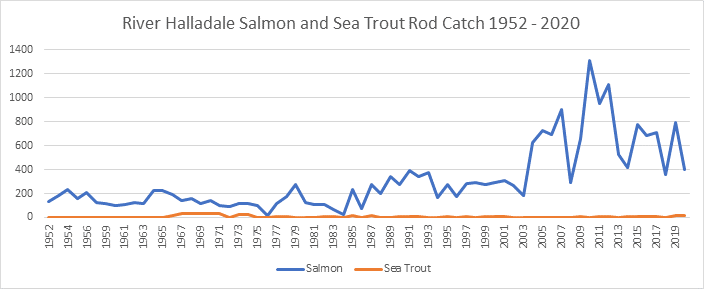
The river is divided into six beats, the lower four beats, with three rods on each, fished in rotation. In a normal year the eight miles of the four lower beats would traditionally produce in the region of 300 fish, while the upper two beats might have 50. Recent years, however, have seen an improvement in the salmon catch. 2010 to 2012 saw exceptional catches of salmon (over 1200 fish in 2010) with the more recent five year average for the season hovering around 600 fish. The 2006 season produced the best catch of spring salmon on record, with 203 salmon taken before mid June. The fishing is usually let in conjunction with holiday cottage accommodation.
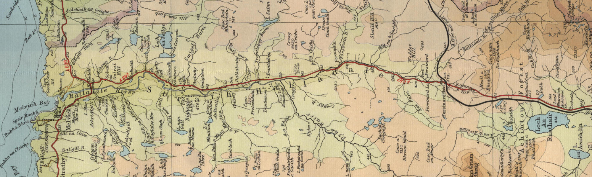
River Halladale Map
Tap or click on the map below to view full size image

Note: the maps on this website are extracts from the Bartholomew “Half Inch” map series dating back to the middle of the twentieth century. There have been many changes since the maps were made, and much of the human detail, e.g. buildings and roads, will have changed over the period. It is to be hoped, however, that the character of our Scottish rivers, and the trout and salmon in them, will not have altered too dramatically over the years and that they may still offer the wonderful fishing prospects of days gone by. Bearing the above in mind, anyone planning a fishing or walking trip in Scotland is advised to equip themselves with a compass and the appropriate up-to-date Ordnance Survey map, the most useful for the angler probably being the Landranger series, scale 1:50,000. For Halladale, see O.S. map number 10.
For further information about the fishing on the Halladale see River Halladale Fishing
For information about the trout fishing in the area see Trout Fishing Scotland